From BiblePlaces.com, a really handy little list:
A family member asked me for a brief list of major regions in the biblical world that are mentioned in the news today by other names. Since most Bible dictionaries do not have entries for the modern names, this list is intended to bridge that gap. With the ancient names in hand, you can consult a Bible dictionary for more details.
Go check it out.
This is important, especially when teaching children the Bible. We want them to learn that it is describing real places, real people, real events that really happened. If they see places called Ammon and Moab in the Bible, and then go look on a map and don’t see it, they can wonder if it is all real.
Sometimes, too, we understand the text better if we know the actual geography. Don’t let ignorance of something that is easy to learn trip you up. We can identify, or at least make an educated guess at, most of the places named in the Bible.

Good start to a list, but those are the easy ones!
I’d love to see an expanded list showing the Biblical name and then the corresponding modern name with any other historical names—all tied to a map.
For example:
I Sam 31:10 Bethshan — now called Beit She’an; also called Scythopolis under the Hellenistic period and was the only town of the Decapolis located west of the Jordan River.
Of course, I probably asking a lot, aren’t I?
Ha! Should be easy, only take a year or three. 🙂
Yes, that would be nice. It probably is on the Internet somewhere.
Ok, here’s one. http://www.biblemap.org/. Put in Genesis 37 to see how it works. Not exactly what you were looking for, but pretty neat.
Now that’s pretty neat, indeed!
Thank you!
This has been done in Google Earth. You can download this file and open in Google Earth.
Link
Ok, this one is pretty neat, too. Install and open Google Earth, then click on the link Theron provided. Zoom into Israle, and you can see places like Samaria and Dothan. Next to at least some of them is a little white square, and if you click on that it pulls up the history of the place, including what it has been called through the years.
Here’s what it says about Mount Gerizim:
Mount Gerizim
ger’-i-zim, ge-ri’-zim (har gerizzim):1. Scriptural References:
Named in the directions for the reading of the law (De 11:29), and in the account of that great ceremony (De 27:12; Jos 8:33 f). Mts. Ebal and Gerizim stood over against each other, and on their sides the peoples were placed, half upon one and half upon the other, while in the vale which separates the mountains stood the ark, with the Levites. Those who stood on Gerizim responded to the blessings, those on Mt. Ebal to the cursings, as these were spoken “with a loud voice” by the Levites. From a spur of Mt. Gerizim Jotham spoke his taunting parable to the men of Shechem (Jud 9:7). The name appears no more in canonical Scripture. In consequence of the dispute which arose over the marriage of Manasseh, who belonged to the high-priestly family, with a daughter of Sanballat the Horonite (Ne 13:28), a temple was built on Gerizim as a rival to that in Jerusalem (circa 432 BC). This was the beginning of the schism which lasts to the present day (Ant., XI, viii, 2, 4). See SAMARITANS. The temple was destroyed by John Hyrcanus circa 110 BC (Ant., XIII, ix, 1; BJ, I, ii, 6).
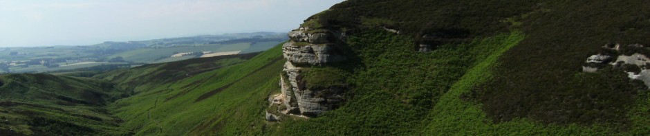
2. Description:
Mt. Gerizim, the modern Jebel et-Tur, stands on the South, Mt. Ebal on the North, of the narrow pass which cuts through the mountain range, opening a way from the sea to the Jordan. In the throat of this pass to the West, on the South of the vale, and close to the foot of Gerizim, lies the town of Nablus, the ancient Shechem. Here copious fountains rise, filling the valley with beauty and fruitfulness. The sides of the mountain are steep and rocky on East and North; on the West the ascent is more gradual, and here, by means of a system of terraces carried almost to the summit, it is cultivated with great care and success. Its height is 2,849 ft. above the level of the sea, 228 ft. lower than its northern companion.
3. Samaritan Traditions:
Abraham came through the pass and camped near Gerizim at the oak of Moreh (Ge 12:6). According to Samaritan tradition it was on this mountain that he prepared to sacrifice Isaac, and at Salem, not far distant, he met Melchizedek (Ge 14:17 ). The scene of Jacob’s dream is placed at Khirbet Lauzeh on the summit (Ge 28:11 f). In a little hollow West of the ridge, the Samaritans annually celebrate the Passover in accordance with the directions of the Pentateuch. This is done in the open air, their temple having long since disappeared.
4. Antiquities:
The most important remains on the mountain today are those of Justinian’s fortress, built in 533 AD, to protect the church which had been erected in 475 AD. Near the center of the plateau is a bare piece of rock, on which, tradition says, the altar stood in the Samaritan temple. A cup-like hollow in it may have been used for libations. In the western wall of el-Qal`ah, Justinian’s castle, there are 12 stones under which, it is said, are the stones which Israel took from the bed of the Jordan (Jos 4:20).
Gerizim was certainly “this mountain” pointed to by the woman of Samaria in her conversation with Jesus (Joh 4:20 f); the cliffs of the mountain almost overhanging the Well of Jacob.
For the reason why Gerizim was chosen for the blessing and Ebal for the cursing we are left to conjecture. The directions were fixed by one looking to the East, not, as with us, looking to the North. For one standing in the valley, therefore, Gerizim was on the right hand, “the side of good fortune” (Driver, Deuteronomy on 11:28).
Onom places Ebal and Gerizim much nearer the Jordan valley. This was doubtless to meet the difficulty raised by the long distance from Ai to Shechem. But their nearness to the “oaks of Moreh” (De 11:30) points to this locality, and this is confirmed by Josephus, who speaks of Shechem, the metropolis of the Samaritans, as “a city situated at Mt. Gerizim” (Ant., XI, viii, 6).
Andronicus, appointed governor of Gerizim by Antiochus Epiphanes, is mentioned in 2 Macc 5:23 (the King James Version “Garizim”).